
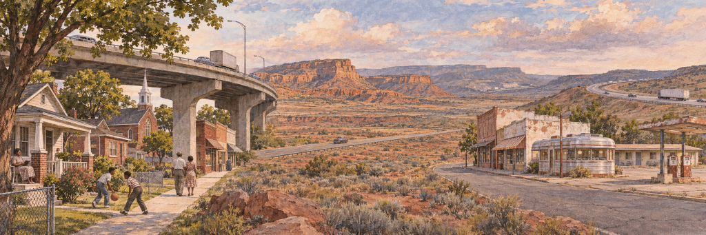
A new highway can arrive wrapped in promises: faster commutes, less congestion, room to grow. In Charlotte, those promises are part of the debate over elevated toll lanes on I-77 South. The city and North Carolina Department of Transportation have signed an agreement committing at least $300 million to community benefits around the corridor.[1] But for people who live near the proposed route, the project also brings an older question back into view: whose community is the highway meant to serve, and whose life will it change? Residents of McCrorey Heights, a historically Black neighborhood shaped by earlier highway construction, have raised concerns about what the expansion could mean for their community.[2]
That question belongs in the history of American roads. Highways connected people and places, opened routes to work and travel, and helped shape the country. They also carried public decisions about which communities mattered, which lands could be entered, and which places could be sacrificed for a faster journey.
The harm did not take one form. In historically Black neighborhoods, highways and urban renewal projects cut through established communities or cleared them away. On Native lands, roads could meet real needs for connection and mobility while also opening access for outside extraction. In small towns, the damage could come from being bypassed: the town remained, but travelers and business moved elsewhere. These histories are connected by the power to decide where a road would go, but the losses were not interchangeable.
The neighborhoods in the way
Charlotte’s Brooklyn neighborhood was a thriving Black community, with churches, businesses, homes, and civic life of its own. In the name of urban renewal, the city cleared Brooklyn block by block. Independence Boulevard was built through the area, changing the shape of downtown and scattering people who had made a neighborhood there. Families lost homes and businesses, but the destruction reached beyond property. It broke up the routines and relationships that made Brooklyn a place where people knew one another and built a life together. More than 7,000 people were displaced, and the promised redevelopment did not replace the homes and businesses that had been demolished.[3][4]
Charlotte’s history did not end with Brooklyn. McCrorey Heights, a community built by Black families facing exclusion from other neighborhoods, later lived through the construction of the Brookshire Freeway. Residents asked officials to reroute it. The road went ahead. The current I-77 debate feels different in its details and includes new commitments to community benefits and connections, but the fear of repeating an old pattern is grounded in memory.[2][5]
The loss was not only visible in the blocks removed or divided. James Black, reflecting on urban renewal in Charlotte, said, “there’s no landmark, there’s no identity.” That absence is part of what a highway can leave behind. A familiar corner, a church, a store where neighbors met: these are small things only until they are gone.[3]
Charlotte was not alone. In Miami, the construction of I-95 cut through Overtown, a historically Black neighborhood with a rich cultural and commercial life. In St. Paul, I-94 divided Rondo, despite residents’ efforts to stop the route and proposals for alternatives. North Nashville faced similar pressures as the interstate system crossed established Black neighborhoods. Federal highway officials themselves acknowledged that some city leaders viewed highways as a way to clear poor, largely Black neighborhoods. The history is specific from place to place, but the repeated result was that Black communities were asked to carry a disproportionate share of the cost of urban “progress.”[6][7]
Roads across Native lands
The story changes when we turn to Native Nations. Roads could answer needs that Native communities had named themselves: reaching schools, clinics, jobs, relatives, and markets across large rural territories. The Navajo Nation’s leaders sought roads and investment, and the 1950 Navajo-Hopi Rehabilitation Act provided funds for road construction. These roads could support connection and self-development; it would be wrong to treat every road as something imposed on a community that wanted none.[8]
But a road built to meet one need could also serve another. On the Navajo Nation, roads built or improved by the Atomic Energy Commission opened remote areas to uranium prospecting and mining. Federal investment could therefore help people travel while making it easier for outside interests to reach and extract resources. Historian Justin Shapiro describes how federal road plans could conflict with Navajo goals for development, particularly when routes served mines and outside access. The road did not have a single meaning; it depended on who planned it, who controlled it, and who benefited from what it made reachable.[8][9]
The consequences of uranium mining were severe. Between 1944 and 1986, nearly 30 million tons of uranium ore were extracted from Navajo lands, leaving more than 500 abandoned uranium mines. Uranium miners faced elevated risks of lung cancer and other respiratory disease. A study of Navajo men found a strong association between a history of underground uranium mining and lung cancer.[10][11] Former miners described dangerous conditions, including inadequate ventilation and a lack of protective equipment.[12]
Nearby families and communities faced exposure concerns from contaminated water, dust, homes, and building materials. The evidence linking mining exposure to illness is strongest for miners; the full scope of community health impacts is harder to measure and should not be overstated. That uncertainty does not make the contamination or the exposure concerns disappear. The federal cleanup effort itself has addressed contaminated homes, water supplies, and abandoned mines on and near Navajo land.[10]
The law governing roads across reservations also changed over time and did not offer one uniform rule for every Nation. A 1901 statute allowed the Interior Secretary to permit highways across reservation lands. A 1948 law required tribal consent for rights-of-way involving certain tribes. Those distinctions matter: tribal authority and consent were not always treated the same way, and a road’s benefits to a community did not erase questions about control over its land.[13][14]
Native people were not simply waiting for outside governments to decide what they needed. Navajo Delegate Daniel Tso wryly called a poorly maintained road a “superhighway”; local people eventually raised money and did the work to improve it. The remark carries both frustration and agency: roads mattered, but so did the right to decide what was needed and the responsibility to make officials answer for what they had promised.[15]
The towns the highway passed by
A highway can change a town without ever running through its heart. It can carry travelers somewhere else, and leave the old road quiet.
That was the turning point for many towns along Route 66. For decades, the road brought a steady stream of people through the places that depended on them: gas stations, diners, motels, repair shops, and stores. When the interstates offered a faster route, travelers no longer had to stop. The town remained where it had always been, but its place in the country’s daily movement had changed.
Glenrio, on the Texas–New Mexico border, makes the change visible. Its boom years ended when Interstate 40 bypassed it in 1975. Today, the National Park Service describes the historic district as containing the old Route 66 roadbed and 17 abandoned buildings. Those empty structures are more than the remnants of a roadside economy. They are the shape of a place built around people passing through, and then left behind when the traffic moved on.[16]
Seligman, Arizona, tells a more personal version of the same story. Angel Delgadillo had grown up beside Route 66 and watched the freeway take travelers away from the town. He recalled the loss of four filling stations, two motels, and two restaurants, and said, “My town was being killed.” His words hold the scale of the change in one sentence: businesses closed, but so did the ordinary encounters that had made the road part of the town’s life.[17]
Seligman’s story also includes a response. In 1987, Delgadillo helped organize residents to preserve the old road as Historic Route 66. Their effort gave the town a new reason for travelers to stop: people began coming to see the road and the history that had nearly disappeared with it. Preservation did not restore the old traffic or undo the years of lost business. But the community found a way to keep its story visible, and to make memory part of its future.[18]
Route 66 is the most familiar story, but the pattern extended across the country. The National Road, which became U.S. 40, had once carried people and commerce across the country. In the 1960s, Interstate 70 bypassed much of it. The Federal Highway Administration notes that many businesses were left by the wayside. The businesses may have been smaller and less famous than Route 66’s neon motels, but the change was similar: traffic that had once passed through communities now moved along a faster corridor.[19]
Statesboro, Georgia, offers another variation. U.S. 301 had become a major route for vacationers heading south, and local accounts describe Statesboro as a “tourist city.” Before Interstate 95 opened in 1977, the number of out-of-state cars passing through could exceed 20,000 a day during peak periods. Later changes—including the rerouting of U.S. 301 around Statesboro—helped dry up tourist revenue for downtown businesses. The highway story here was not one single road suddenly abandoning one town; it was a gradual shift in how people traveled, and in whether their journeys brought them through the center of town.[20][21][22]
These communities were not all affected in the same way, and the highway was not always the only force shaping their fortunes. Local economies already had their own pressures. But when a town’s businesses depended on travelers, moving traffic elsewhere could put the town’s main street, its familiar landmarks, and its sense of purpose under strain. A diner or motel might close one at a time; with each closing, a place lost another piece of the life that had gathered around the old road.[23]
There is a particular kind of sadness in being passed by. The town is still there. Its buildings, signs, and roadbed may remain. But the stream of strangers who once filled its rooms, asked for directions, bought a meal, or stopped to fix a tire has gone another way. The highway made the country easier to cross. For some communities, it also made it easier to pass them without ever knowing they were there.
What we call progress
I keep coming back to the line I set aside: we like to hold ourselves in high esteem, when all we are is well-spoken, well-dressed, educated thieves, rogues, and bandits. The words are angry, and some of that anger belongs here. We have often described these projects with the polished language of progress while asking other people to absorb the loss.
The stories are different. A neighborhood was cleared or divided. Native Nations pursued roads for their own communities while federal routes also opened land to extraction. Towns built around older roads watched travelers go elsewhere. A highway could connect people and still dispossess them; it could answer one community’s needs while serving someone else’s interests; it could make travel easier and make a town easier to overlook.
That is the history we have to hold together. If we talk only about the miles built and the time saved, we leave out the people who paid in homes, health, land, livelihoods, and the ordinary life of a community. And if we speak about roads only as instruments of harm, we erase the people who needed them, fought for them, built them, and tried to make them serve their own futures.
The question is what we do with that fuller history when the next road is proposed. Progress should not be measured only by how quickly we can get through a place. It should also be measured by whether the people who live there have a say in what is built, what is taken, and what they are left with afterward.
Sources
Federal Highway Administration, “Along the Interstates: Seeing the Roadside”.
City of Charlotte, “City & NCDOT Sign Agreement for I-77 South Corridor Community Benefits”.
Charlotte Observer, “McCrorey Heights memories amid I-77 South expansion debate”; McCrorey Heights, “Our History”.
Brooklyn Oral History Project, UNC Charlotte, James Black interview.
Brooklyn Oral History Project, UNC Charlotte, Brooklyn timeline; Levine Museum of the New South, “Brooklyn Was Home”.
Charlotte Observer, “McCrorey Heights seek protections amid Charlotte highway plans”.
Federal Highway Administration, “The Greatest Decade: 1956–1966”.
U.S. Department of Transportation, “Using Public Engagement to Respond to Community Needs and Priorities: Rethinking I-94 and Reconnecting Communities in the Twin Cities”.
National Park Service, Navajo National Monument: A Place and Its People—An Administrative History, chapter 4.
Justin Shapiro, “Environmental control: charting a course for the Navajo reservation through road construction, 1945–1978,” Journal of Transport History.
U.S. Environmental Protection Agency, “Navajo Nation Abandoned Uranium Mines Cleanup”.
Gilliland et al., “Uranium Mining and Lung Cancer Among Navajo Men in New Mexico and Arizona, 1969 to 1993,” NIOSH/CDC.
Living on Earth, “Navajo Uranium Miners”.
25 U.S.C. § 311, “Opening highways”.
25 U.S.C. § 324, “Consent of certain tribes; consent of individual Indians”.
Sonia Grant, “Gridlock: Infrastructure and Jurisdiction in Eastern Navajo Agency,” Antipode.
National Park Service, “Glenrio Historic District”.
Los Angeles Times, “Route 66: ‘I Stayed Disgusted for Years’ After I-40”.
Arizona Highways, “Seligman”.
Federal Highway Administration, “The National Road”.
David T. Martin, The Second Night’s Stop: Effects of U.S. Highway 301, Tourism, and Interstate 95 upon Statesboro, Georgia, 1950–1975.
Bulloch History, “Marker: Statesboro”.
Georgia Trend, “Statesboro/Bulloch County”.


Leave a Reply